Storm Model
Overview
STORM is part of the climatological component of the CUWALID system. STORM fills the gap between the climate forecasting and the hydrological forecast by providing an esential input for the hydrological forecasting model, precipitation.
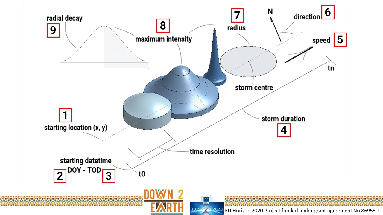
STORM provides stochastic realization of precipitation fields at high spatial (0.1 degree) and temporal resolution (30 min). STORM generates realistic precipitation events across entire regions specified by user. STORM was developed by characterizing key properties of precipitation events (e.g. intensity, duration, extend, direction) observed in global datasets of precipitation and remote sensing data at high spatial and temporal resolutions.
A detailed description of the component as well as documentation can be found in: STORM